New Zealanders are being given a classic late-winter planning message this week: cold starts first, then another change to watch as the week develops.
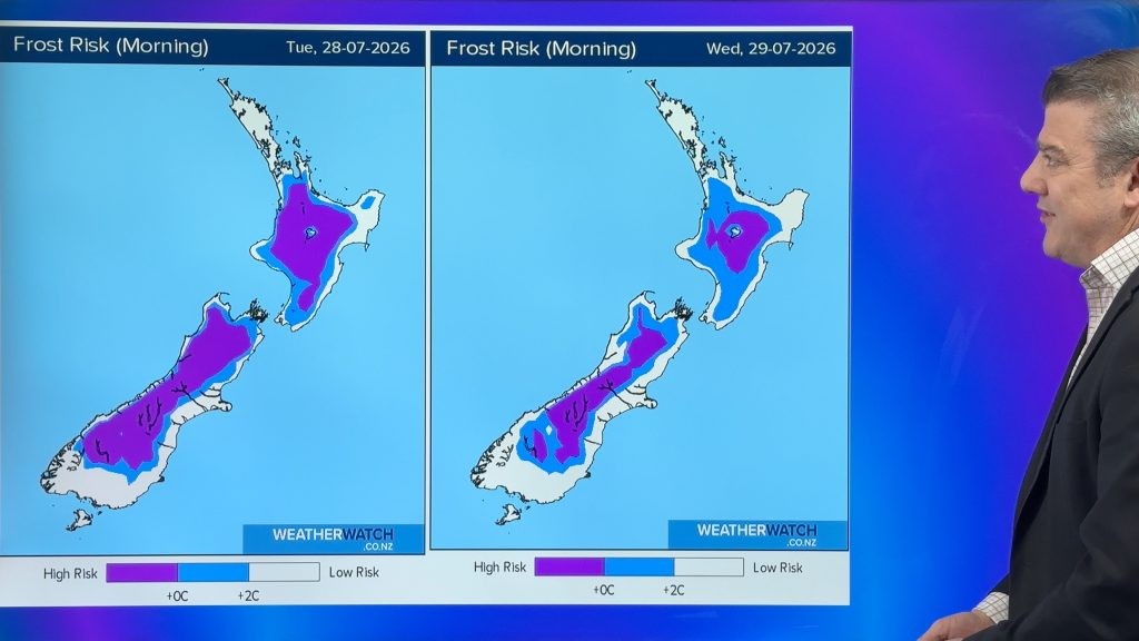
WeatherWatch's latest homepage update, published on Monday 27 July, says high pressure will move across New Zealand over the next few days, bringing more cold nights and mornings with frost risk. It also says a nor'wester is expected to develop and spread up the country mid to late week, limiting frosts for a time and drawing in rain for some areas. That pattern is consistent with MetService's severe weather outlook for Tuesday 28 July, which describes a ridge moving slowly northeast over the North Island.
The important point for households is timing. Frost risk affects morning routines before it becomes a dramatic weather headline. Drivers may need to allow for ice on windscreens and colder shaded roads, especially inland and in the south. Farmers, growers and people with outdoor work will be watching overnight temperatures and wind changes more closely than the headline afternoon forecast.
WeatherWatch's earlier cold-change report for late July described downpours, squally showers and a chance of thunderstorms with the prior cold change, followed by easing winds and widespread frost risk as high pressure returned. That means the country is moving through a transition rather than sitting in a single static weather pattern. The heavy-weather risk may ease in many places, but cold air and calm nights can still create practical problems.
For city readers, the week is likely to feel uneven. A fine or settled afternoon can follow a sharp morning, and a warmer-feeling northwester later in the week can arrive with its own rain and wind trade-offs. The safest advice is to follow local forecasts rather than national shorthand. Auckland, Wellington, Christchurch, Queenstown and inland rural districts can all sit under the same broad system while experiencing very different day-to-day impacts.
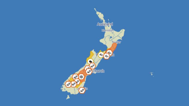
For travel, the message is similar. The period does not currently read as a nationwide emergency pattern, but late-July frost and low-level cold can still affect early starts, rural highways and school or work commutes. Mountain and park users should use specific local forecasts, because alpine and inland conditions can shift more quickly than lowland city forecasts suggest.
MetService remains the formal severe-weather warning authority, so warning and watch pages should be checked before decisions that involve travel, outdoor work or vulnerable people. WeatherWatch adds useful public-facing context about the broader setup and likely feel of the week. Together, the sources point to a practical forecast: New Zealand gets a quieter ridge and frosty mornings first, with the next rain-bearing change to monitor as the week progresses.
The article avoids overstating the risk. The verified sources support cold mornings, frost risk, high pressure and later-week rain potential. They do not support claiming a current nationwide severe storm emergency.
That measured framing is important. Ordinary winter hazards still deserve attention, especially when cold starts arrive before daylight and before many people have checked an updated local forecast.
The best public service is repetition without alarm: check the warning page, check the town forecast, and treat frost as a planning issue before it becomes a delay.