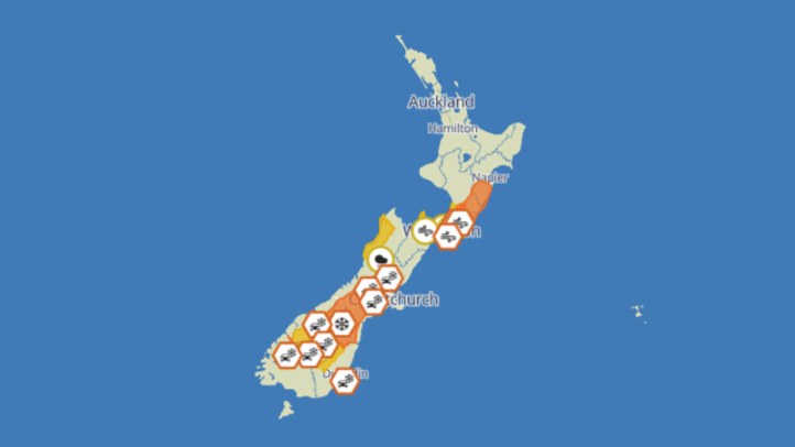

MetService's severe weather outlook has given most of New Zealand a more settled message after an active winter spell, with the latest outlook saying a front moves north over the North Island before a strong southwest flow follows over eastern parts of the country. The key phrase for households and travellers is that the risk of severe weather is minimal.
Minimal risk does not mean no weather. It means the current setup is not expected to meet severe-warning thresholds across the main outlook areas. People can still face showers, cold air, gusty exposed conditions, changing road surfaces and reduced comfort outside. In winter, ordinary weather can still matter if it arrives during school runs, commuting peaks, rural work or longer road trips.
WeatherWatch's warnings page also showed no active MetService warnings when checked for this run. That supports the same practical reading: New Zealanders should keep an eye on local forecasts, but the national severe-weather picture is not carrying the same urgency as a red, orange or heavy-warning day.
The southwest flow is still worth noting. Eastern districts can feel a sharp change when air moves in behind a front, especially if showers and lower temperatures follow. Canterbury, Otago, the eastern North Island and exposed coastal areas often notice these patterns through wind chill, rougher seas and fast-changing cloud. Farmers, contractors and people working outside should read the local forecast rather than relying only on the national headline.
For the North Island, the front moving north means wet weather may clear in stages rather than everywhere at once. That is common with frontal systems. One district can already be drying while another is still under cloud and showers. Drivers should treat the timing carefully, especially on rural roads where surface water, slips or fallen debris can linger after the worst rain has passed.
The quieter severe-weather outlook is also a useful moment for preparedness. Emergency planning usually gets attention only when a warning is already live, but the best time to check torches, batteries, gutters, medication supplies and vehicle basics is when there is breathing room. Winter weather can change quickly in New Zealand, and a minimal-risk outlook today does not remove the need to be ready for the next front.
Travellers should keep checking transport updates. A non-severe weather day can still affect alpine passes, ferry comfort, regional flights or exposed roads. Conditions that are manageable for locals can surprise visitors who are not used to New Zealand's short distances between coast, hill country and mountain terrain.
The main takeaway is measured. There is no need to inflate the outlook into a weather scare. The current national signal is lower-risk, with no active warnings showing on the MetService warning page and MetService describing minimal severe risk. The sensible response is to use the quieter window well: check local forecasts, plan around cold southwest changes, and keep winter readiness practical rather than dramatic.
Schools, sports clubs and event organisers can use the same approach. A minimal severe-risk outlook supports normal planning, but outdoor schedules should still leave room for local showers, cold wind and transport delays.