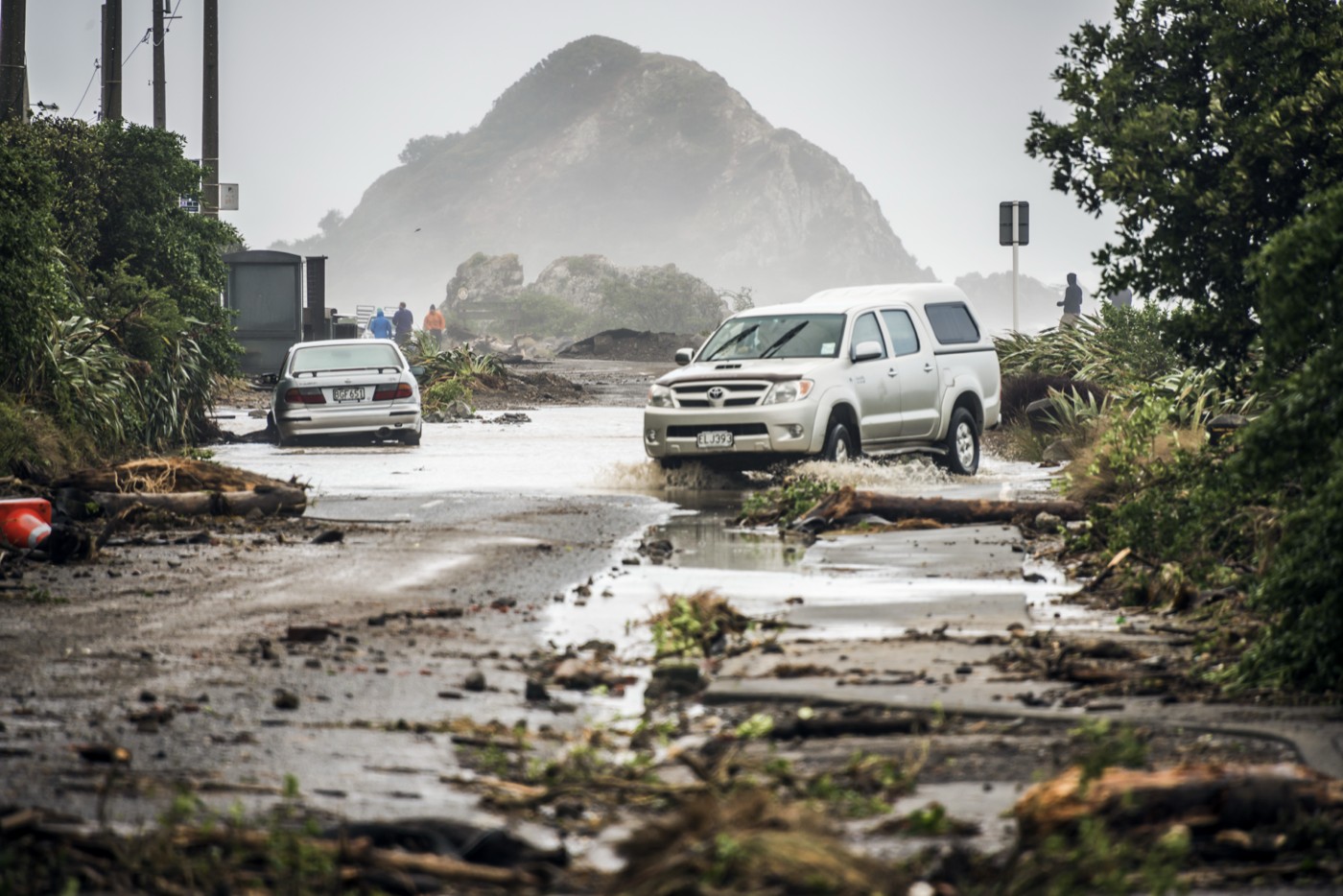
A state of emergency in parts of Wellington and warnings of waves reaching up to 10 metres along the east of the country have turned a coastal weather event into a national safety story. 1News reported that Wellington City Mayor Andrew Little declared a state of emergency for the city's Southern and Eastern wards on Monday afternoon, with mandatory evacuation orders for waterfront properties in several south-coast areas.
The most serious risk window was forecast for Tuesday, 9 June. 1News reported that Wellington's coastline from Cape Terawhiti to Turakirae Head could see combined waves of 7 to 8 metres around midday Tuesday, while the Wairarapa coast from Turakirae Head to Mataikona could see larger combined waves of 9 to 10 metres late Tuesday morning. Wellington Regional Emergency Management said the swells could be among the largest to hit the region in recent years.
Mandatory evacuations were ordered from 9am for waterfront properties in Owhiro Bay, Island Bay, Houghton Bay and Breaker Bay. Lyall Bay was not part of the evacuation order, according to the council. An emergency assistance centre was set up at Wellington South Baptist Church for people without somewhere to go, and residents were told to expect extensive road closures on Tuesday.
The event has also disrupted transport. Both major Cook Strait ferry operators cancelled multiple sailings, with Bluebridge cutting a Monday evening Wellington-to-Picton service and Tuesday morning departures, while Interislander cancelled Tuesday sailings. Ferry cancellations show how a coastal hazard can move quickly from a local safety issue into a national transport problem, affecting freight, tourists, commuters and supply chains between the islands.
MetService meteorologist Devlin Lynden told 1News the swell was being driven by a deep low pressure system south of the country, generating very strong southwesterly winds. The combination of wind speed and fetch, meaning the distance over which a swell can build, had allowed the southwesterly swell to grow across a long stretch of the Southern Ocean. That is why conditions could deteriorate rapidly rather than gradually.
The risk is not only wave height. Large, fast-rising swells can push water and debris onto roads, undermine low-lying property, catch pedestrians by surprise and make harbour entrances dangerous for small craft. Emergency managers urged residents who had been affected by previous swell events to move items from low-lying areas, prepare a grab bag and make a plan. Recreational boaties were warned to use extreme caution, especially near harbour entrances and bar crossings.
The event is also a reminder that coastal resilience is not a future problem. Wellington and Wairarapa communities already live with exposed roads, homes, seawalls, surf clubs, promenades and infrastructure close to powerful water. A single swell event does not answer every climate or planning question, but it does show why councils need updated hazard maps, evacuation plans, transport alternatives and clear public communication.
For residents, the advice is straightforward: follow Civil Defence, council and MetService updates; stay away from exposed coasts during the peak period; do not drive through sea water or debris; and treat evacuation orders as safety instructions rather than suggestions. The waves are dramatic, but the real test is whether people stay clear long enough for the system to pass without avoidable harm.