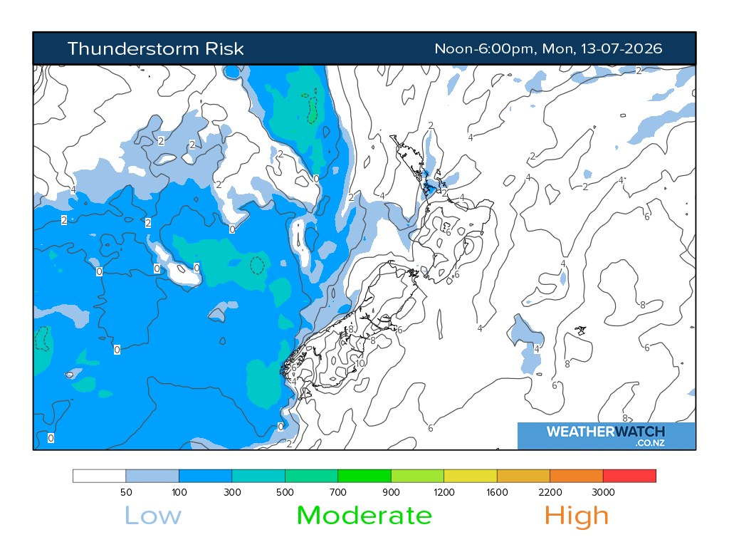
A front reaching the South Island on Monday is the main weather risk for New Zealand today, with official and specialist forecast sources pointing to a wet and gusty change in the west and south. MetService's severe weather outlook for Monday 13 July says a front is expected to reach the South Island in the second half of the day, with strong northwesterly winds developing over the South Island. WeatherWatch's thunderstorm outlook adds more detail for Fiordland, saying a moist northerly flow moves onto the region during Monday morning.
The most practical risk is not a broad national storm but localised heavy rain and wind where the front hits first. WeatherWatch says there is a moderate thunderstorm risk in Fiordland towards midday, with heavy rain of 10 to 25 millimetres an hour and strong wind gusts. Its later outlook says the front is followed by an unstable showery air mass moving east over the South Island, with Fiordland and Westland carrying the more active risk areas and wind gusts in Fiordland potentially reaching 90 to 100 kilometres an hour in thunderstorms.
That combination matters for drivers, trampers, farmers, contractors and holiday travellers. Fiordland and the West Coast are used to rain, but intensity still changes the risk profile. Heavy bursts can lift streams quickly, reduce visibility on winding roads, create surface flooding, and make slips more likely in places where ground has already been wet. Strong gusts also complicate high-sided vehicles, exposed bridges, boat movements and outdoor work.
The rest of the country is not facing the same thunderstorm signal in the available outlooks, but the front still belongs in the national plan. Weather that starts on the western South Island can affect flights, ferry schedules, alpine routes and freight timing even when the sharpest warnings are regional. A missed connection or closed pass can become a national logistics issue quickly, especially during winter travel periods.
The advice for readers is simple: check the latest local warning before travelling, do not treat a general forecast as enough for alpine or coastal decisions, and build buffer time into South Island routes. If an activity depends on river levels, exposed roads, ferries or small aircraft, the forecast should be checked again close to departure rather than the night before.
This is a safe weather article because it is tied to current forecast products rather than speculation. The strongest confirmed details are the arriving South Island front, the Fiordland heavy-rain and gust risk, and the broader need for Monday travel caution across the lower half of the country.
The warning also matters for people far from Fiordland because South Island fronts rarely stay as a local inconvenience. Rain in the ranges can affect highway confidence, freight timing, visitor plans, farm work and emergency-service readiness. A front that begins as a West Coast or Fiordland concern can still shape travel decisions for people heading through alpine routes or planning connections later in the week. The useful response is not alarm, but early adjustment: check official warnings, watch river and road updates, secure loose outdoor items, avoid unnecessary exposure in exposed passes and keep enough flexibility for weather to slow the day down.