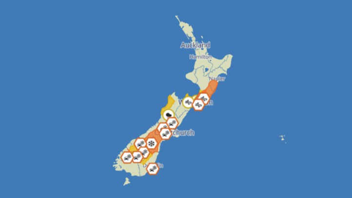
MetService's severe weather outlook gives much of New Zealand a quieter start to July, with high pressure covering large parts of the country and minimal risk of severe weather for Wednesday. That is a practical change after a run of winter systems that left some regions dealing with slips, bridge damage, power cuts and travel disruption. Quiet weather does not remove winter risk, but it gives households, councils and contractors a useful planning window.
The key word is high pressure. Under a ridge or anticyclone, many places can see lighter winds, clearer skies and a lower chance of organised severe rain or gales. For people who have been watching warnings and road closures, that can feel like relief. For farmers, tradies, transport operators and councils, it can create the conditions needed for inspections, repairs, spraying, deliveries or catching up on outdoor work.
But settled winter weather has its own hazards. Clear skies can allow overnight temperatures to drop quickly, especially inland and in the South Island. Frost can affect roads, footpaths, windscreens, stock water, garden plants and early-morning travel. Fog can reduce visibility around valleys, airports and low-lying roads. The absence of a red or orange warning is not the same as the absence of risk for people leaving home before sunrise.
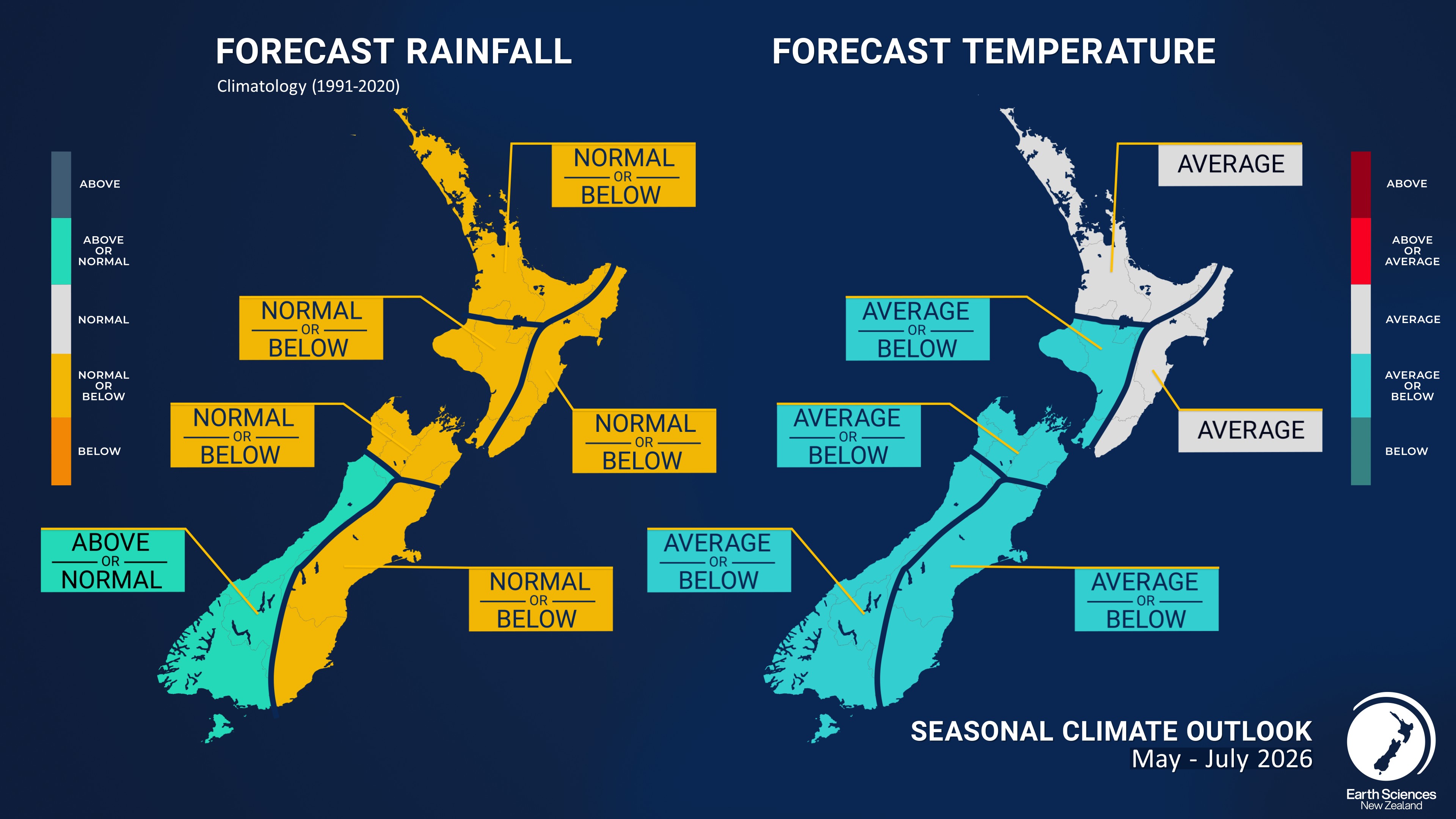
NIWA's May-July seasonal outlook gives useful background for that message. It says occasional cold snaps are possible, especially under persistent high pressure where fog, frost and cold nighttime temperatures can occur. The outlook also points to near-normal or below-normal rainfall being likely in several eastern and northern regions as the season progresses.
The public communication challenge is different from storm communication. During a severe weather event, people need urgent alerts, road closures and emergency advice. During a quiet high-pressure period, they need detail that helps them use the break well: frost timing, fog patches, road-surface cautions, avalanche or snow information where relevant, and updates if a front is expected to break the settled pattern.
Drivers should still check local conditions before assuming a calm forecast means easy travel. Bridges and rural roads damaged by previous rain can remain restricted after the sky clears. Frost-prone routes can be slippery even when the wider day becomes sunny. People travelling early for school holidays, work or sport should allow extra time, clear windscreens properly and avoid sudden braking on shaded roads.
The quieter outlook also matters for recovery crews. Fine weather can speed inspections of slips, culverts, roofs, power lines and drainage systems. Councils should use the window to give specific public updates on which routes are open, which are under stop-go control and which still need engineering checks.
New Zealand's winter pattern can change quickly, so the message is not to relax completely. It is to use the settled start to July intelligently. MetService's outlook suggests a lower severe-weather risk for now. NIWA's seasonal guidance reminds people that cold nights, frost and fog still belong in the plan.